Sea-Tac against normal, August 2026
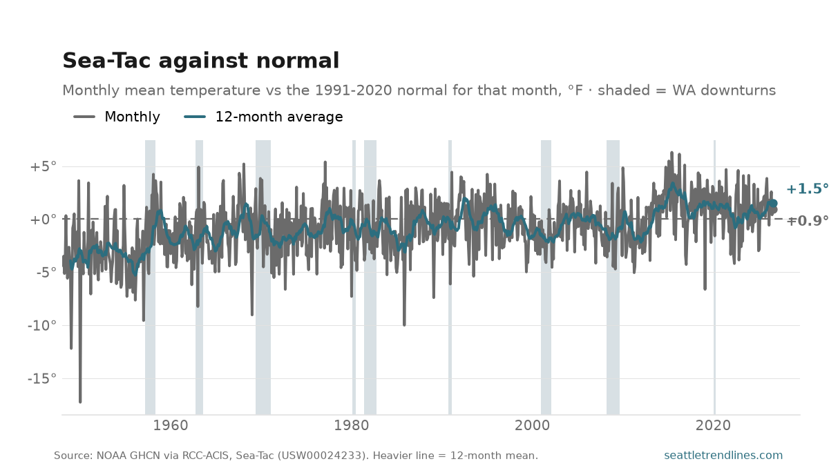
August 2026 at Sea-Tac ran 0.9°F above normal. Normal here is the 1991-2020 average for that same month, which is the standard climate baseline — so this is a comparison with the recent past, not with the start of the record.
Across the whole series, August has averaged -1.1°F against that baseline, over 79 years. The warmest was +4.3 (1967) and the coldest -6.2 (1954). A single month is weather; the reason to post one every month is that the band they fall in has moved — which is what the 12-month average on the chart is there to show.
The station is the caveat, and it is a real one. Sea-Tac is the only continuous daily record in this region back to 1948, and it is an airport twelve miles south of downtown with far more tarmac around the thermometer than it had then. Some of the drift in this line is the airport growing, not the climate — that is why the anomaly is measured against a fixed 1991-2020 baseline rather than against the 1950s, which would read the pavement as warming. It is still the best record there is.
Source: NOAA Global Historical Climatology Network daily records for Seattle-Tacoma International Airport (USW00024233), via RCC-ACIS, aggregated to monthly means and differenced against the 1991-2020 normal for each calendar month. Auto-generated each build.